

What's new
Walks by the sea
Fred Olsen's Cruise lines for 2025
Christmas books reviews
DVD reviews
Doctor Who
Our new website - Enjoy Britain online www.enjoybritainonline.co.uk/
New CD releases
Discover Knightsbridge, London
Birdwatching and more

Standing astride the summit of windswept Kinder Scout, looking down vertiginously on the valley below, you really feel you’re on the rooftop of the realm.
What had started out as a gentle stroll from Edale over a partly paved path had ended with clambering over rocks made slippery by a stream – as I found to my cost – then scrambling up scree to the peat-layered peak.
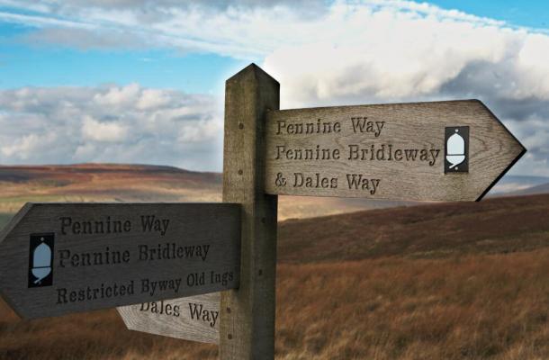
The last time I’d been up Kinder Scout, the highest point in the Peak District and the start of the Pennine Way, was nearly 50 years ago with the school rambling club in the Sixties. This was soon after it had been designated Britain’s first National Trail, and this year the Pennine Way is celebrating its 50th anniversary.
Crossing no fewer than three National Parks, it covers almost 270 miles over the ‘backbone of England’ and into southern Scotland. It also spans two National Nature Reserves, an Area of Outstanding Natural Beauty, and 20 Sites of Special Scientific Interest.
For those hardier and more determined souls who aim to complete the Pennine Way in one go, the Kinder Scout leg is just the first of a gruelling two or three weeks of such ascents.
When my partner and I – very much rookie ramblers – made the climb, the landscape seemed unchanged from how I remembered it in the Sixties… unlike my fitness levels. However, I comforted myself with the fact that the 2070ft summit was considerably higher than the meagre 425ft achieved by the free-runner who had climbed the Wembley Stadium arch for the first time the day before! (Technically, Kinder doesn’t have a single specific ‘summit’ as it’s a plateau covering some 15 square miles.)
From the north of Derbyshire’s Peak District, the Pennine Way runs along the Pennine ridge through the Yorkshire Dales, the Northumberland National Park and the Tyne Valley. After a short section along Hadrian’s Wall, it turns north again across the Cheviots, ending at Kirk Yetholm in the Scottish Borders.
The variety of habitats makes it one of the best places in Europe to see birds such as breeding waders in spring and early summer. Although it’s less than half the length of the South West Coastal Path (Choice, June 2014), the Ramblers organisation describes it as one of Britain’s most popular and toughest trails.
The Pennine Way was the brainchild of the walker and writer Tom Stephenson, inspired by similar tracks in the USA. He proposed the idea in the Daily Herald in 1935 in an article titled ‘Wanted: a long green trail’, following the mass trespasses on Kinder Scout in the Thirties, which were pivotal in the creation of Britain’s national parks and the universal ‘Right to Roam’. However, it was to be another 30 years before the Pennine Way was opened, on April 24, 1965.
But it’s not just the scenery that attracts the visitors, spectacular though that is. You can see historical locations such as the southern Pennines – birthplace of the Industrial Revolution – pass near the Haworth home of the Brontë sisters, follow the famous Settle-Carlisle railway and cross Hadrian’s Wall.
An estimated quarter of a million ramblers use the path every year, and thousands of long-distance walkers complete the route annually. This heavy use has boosted the local economies but also, inevitably, has led to erosion of the terrain in places, and teams of conservation workers have been helping preserve footpaths.
Large areas of peat have also disappeared, partly as a result of overgrazing by sheep: for example, the peat around the summit of Kinder Low has vanished to a radius of almost 200 yards. A five-year, £2.5m project was launched in 2011 to restore vast areas of the bare and degraded blanket peat landscape.
Indeed, while we were going up Kinder, we spotted a helicopter with a large tank slung below it spreading lime, seeds and fertiliser on the plateau.
Average walking time is 16 days, but for a first-timer about three weeks is not unusual. Most walkers head from south to north, keeping the wind generally behind them.
The Pennine Way Association says: “Everyone has different objectives relating to the Pennine Way.”
The association has detailed a suggested walk of 18 days which could be extended to 21 days allowing for rest days and travel home.
Not having three weeks to spare, I’ve unavoidably had to focus much of this article on the southern section through the Peak District – perhaps appropriate as this was where it all started 50 years ago – but from contacts with walkers I can vouch for the rest of it being equally spectacular.
There are many guest houses, B&Bs, camp sites and youth hostels en route, though these are obviously limited in upland areas. You can book in advance and even have your luggage transferred between them.
On a multi-day walk, you’re likely to encounter the British weather in all its many varieties, sometimes creating dangerous conditions, particularly in high, windswept and isolated locations.
ThePennineWay website warns: “As with all walks, sound planning is important. There are sections of the route, especially at each end, which require careful thought about accommodation; advance booking is advisable at most times of the year.
“The Pennine Way takes you into isolated country. That is part of the exhilaration, of course, but consider the challenges and responsibilities such country brings with it. Pay close attention to detail in your choice of equipment. Brush up your navigation skills, carry the appropriate large-scale maps and know how to use them.”
A more detailed description of the route will appear in Choice next month, but briefly, the Pennine Way begins its 268-mile journey at Edale in the Peak District. Fittingly, it crosses Kinder Scout, where the pioneering Mass Trespass changed the course of walking history.
The Yorkshire stretch takes you from the Peaks and drops you straight into the atmospheric moorland of West Yorkshire, before bisecting the Yorkshire Dales National Park as the route makes its way northwards. The Cumbrian section crosses the North Pennines Area of Outstanding Natural Beauty, and joins the Hadrian’s Wall Path at Gilsland. Then the Northumberland section runs from the North Pennines AONB, along the Hadrian’s Wall Path past Housesteads Roman Fort and up through the Northumberland National Park.
The final legs of the walk go through the Cheviots before finishing one mile north of Northumberland in the Border village of Kirk Yetholm
To Continue Reading the Full Article, Click Here
Have you ever walked the Penine Way? Want more UK travel news?
To keep up to date with all the latest from Choice, or if you have something you want to share with our team, follow us on Facebook, Twitter, Google+, Instagram and YouTube
Where to holiday and avoid the crowds
A year in cottages
Around the World in 101 nights
Talk a Norfolk walk and enjoy a pint
Fred Olsen Cruise Lines now open for 2025
Fair Stood the Train for France
Emerald Cruises
Solos Holiday Breaks
Take to the water this Autumn
Enjoy an Autumn brunch in London
Discover the charms of Knightsbridge
Last-minute savings on European yacht sailings
Visit this Summer’s Blockbuster Locations
Steam Dreams
Scenic Luxury Cruises & Tours
Birdwatching
Bambi in the Blenheim Bluebells
Adventure Play at Blenheim Palace
Eclipse All Aboard for Cruise Adventures
Camping out at Bert’s Kitchen Garden
Second Guest Sails Free with Emerald Cruises
Dogs at the Palace
London's River Uber
Spend a night with Dennis The Menace
Taking a break at Old Dairy Cottage
Wild Isles with cottage comfort
Summer in the Swiss Alpes
Garden Museum London
Discover Paris
What women travellers want
Florida
Fred Olsen Cruise Lines
Canterbury's tale
Discovering Wales - Places of Worship
Ayers Rock
Discover Ireland
The Dos and Don’ts of Travelling With Leukaemia
Sicily revisited
The road to the Highlands
Amazing Arizona Part 1
Over the Bridge to Skye
Buxton: Gateway to the Peaks
Walking Series: Folkestone
Hills and thrills in the Italian Lakes
Travel News: October
Corsica: Coast and culture
A capital time in London
Happy to be on the Florida Keys
Cruise Special: Around Britain by Boat
The good life in North Wales
Have a capital time in London
Polynesian Paradise
Gardens in the sun
A taste of paradise in Puglia
Music in the mountains
Cruising by coach
A Lakes gem for all seasons
Canada: by seaplane and skytram
Cruising on the crest of a wave
Riding the Rocky Mountaineer
48 hours in Bethlehem
Goa, the go-to destination...
Roaming the Rhone
Doing The Strand
Sheffield: Forging a bright new future
Setting sail for the fjords
Taking it easy on the shores of Lake Garda
Be the best Brit abroad
What's on your British bucket list?
Passage to India
Isle of Wight: Singing the praises of quirky cottages
Zell am See: Alpine Wonderland
Turning back time in Guernsey
Glam under the stars in surprising Staffordshire
Red Square Revisited
Fine dining and a walk on the wild side
Detroit: Dancing in the streets again
Terror and Tourism- are you covered?
Islands in the Sun
Cornwall by Coach
Making Waves on the Med
Tramway Treasury
Sunrise on the Summit
Homage to Catalonia
Pembrokeshire Panorama
The Magic of Amsterdam
Born to be wild on Route 66
Somerset's Seasonal Delights
A topping time in Tirol
Besieged Bosnia: Back in Business
Cruising The Danube
Quest for a Lost Queen
Wiltshire's Winning Ways
We'd rather be in Colorado
Taking it easy in Norfolk
Luscious Lucerne
Arizona: Get Your Kicks on Route 66
Discoveries: Epic Adventure
Northern Ireland: Transformed from the Troubles
Kingston: Town of kings
Extraordinary Israel
Avalon's Avian Haven
Station Vacation
Walks by the sea
Fred Olsen's Cruise lines for 2025
Christmas books reviews
DVD reviews
Doctor Who
Our new website - Enjoy Britain online www.enjoybritainonline.co.uk/
New CD releases
Discover Knightsbridge, London
Birdwatching and more